International Journal of Marine Science, 2017, Vol.7, No.2, 8-18
9
1 Materials and Methods
The skeleton of this work was designed to study the spatial and temporal variation of Rosetta Estuary spit through
collection of historical data and recent information from field and laboratory work.
1.1 Site description
The Nile Delta coast in Egypt is an active system formed by the Nile River sediments discharged into the
Mediterranean Sea through the Rosetta (Rashid) and Damietta promontories (Khafagy et al., 1992). Rosetta
Branch promontory is located on the eastern side of Abu Qir Bay at about 60 km to the east of Alexandria City,
Egypt (Figure 1). Since 1965, the water flow and sediments discharged by Rosetta Branch to the sea have been
reduced due to the establishment of Aswan High Dam and the water control work along the River Nile (El-Sayed
et al., 2007).
Rosetta Estuary is suffered from erosion due to elimination of sediments coming with the Nile water afte r the
establishment of Aswan High Dam. The rate of erosion was 30 m/y until sea wall was built at the eastern and
western entrance of the Rosetta Estuary. The horizontal erosion was stopped but the vertical erosion still work
(Frihy, 1996).
1.2 Historical information
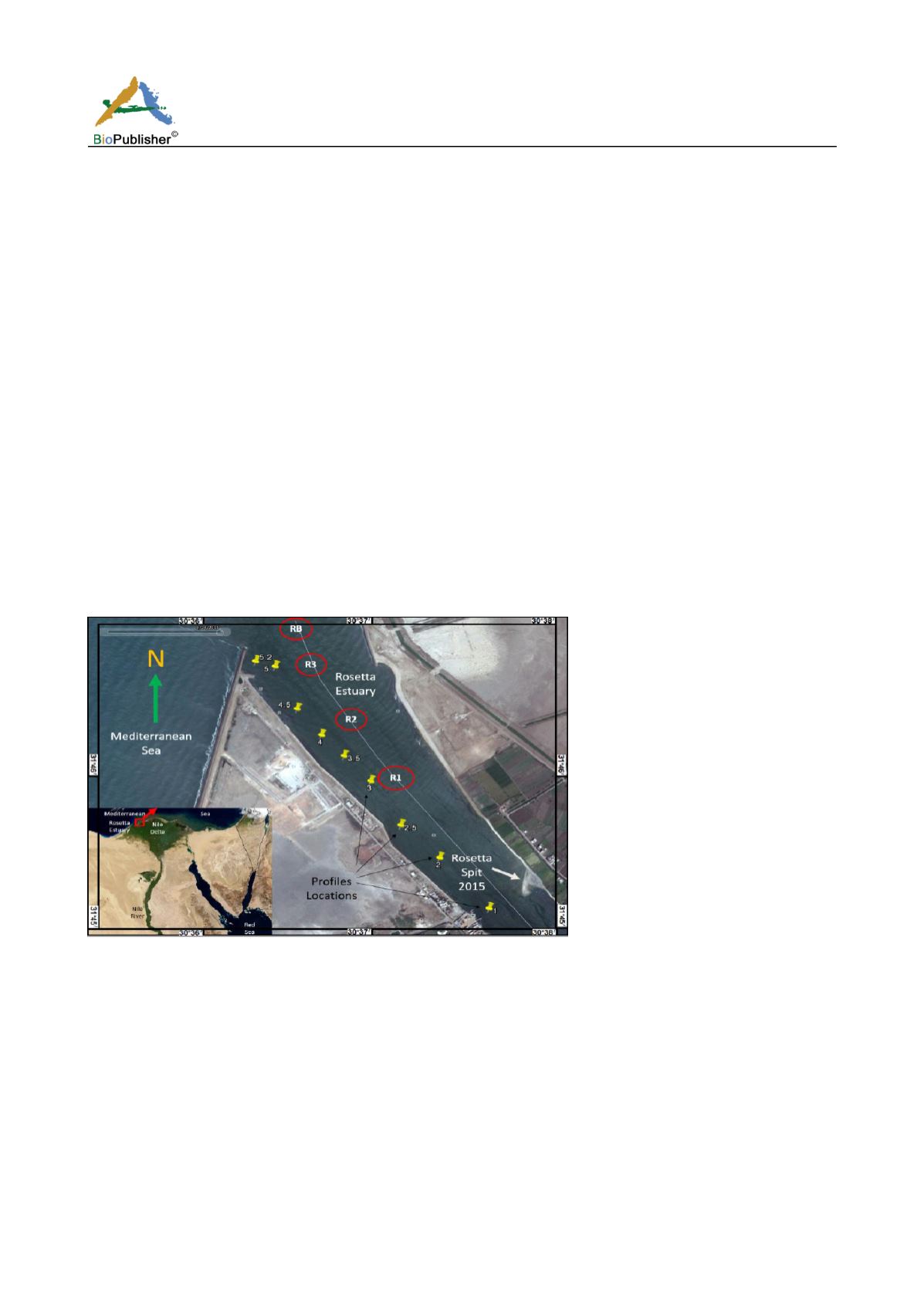
Nine profiles from successive sections of Rosetta Estuary have been determined by Coastal Research Institute
team as shown in Figure 1 with code numbers 1, 2, 2.5, 3, 3.5, 4, 4.5, 5 and 5.2 during 2007. Historical Google
Earth (GE) satellite images have been used to trace the locations of the spit at the Rosetta Estuary. Wind rose has
been drown to check the dominant direction.
Figure 1 Study area at Rosetta estuary
Note: Yellow pins indicates the investigated Nile profiles and the red circles indicates the salinity detection and sediments sampling
sites at 30°36/-30°38/ E and 31°38/-31°47/ N
The amount of water discharged from Rosetta Branch of the Nile River according to the flow of water through
Edfina Barrage during the period from 1956 to 2015 have been introduced. The source of the data is obtained
from the Irrigation Department, the General Authority of Delta Barrages of the Egyptian ministry of Water
Resources and Irrigation and from the published data of Said and Radwan (2009).
1.3 Field and laboratory work
1.3.1 Salinity
During this work in March 2015, salinity profile values within the Rosetta Estuary water were measured in the
field using Aquaread CTD AP-5000 connected with GPS at sites R1, R2, R3 and RB as shown in Figure 1.
Inflatable rubber boat (Zodiac) with engine 30 horse was used for CTD field measurements.


