International Journal of Marine Science, 2017, Vol.7, No.3, 19-30
22
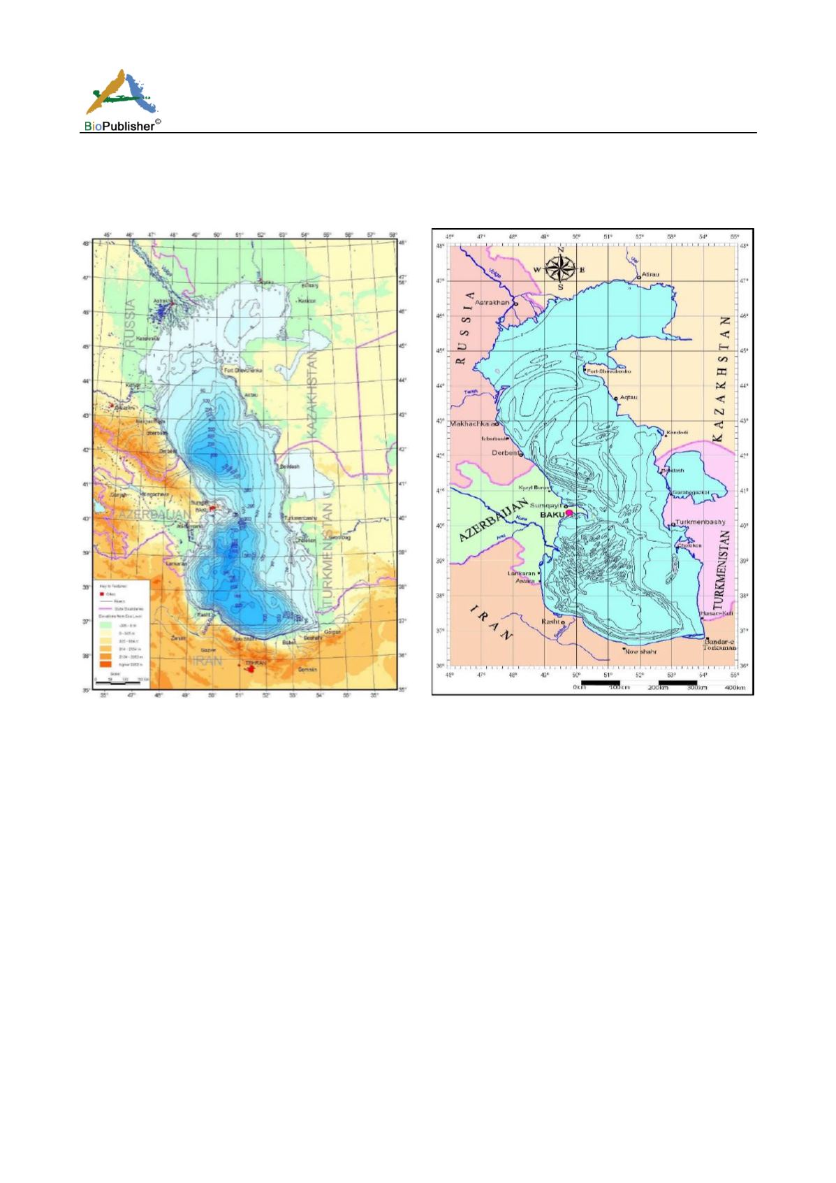
The southern part of Caspian Sea, with the catchment area of about 174200 km
2
, includes the northern skirts of
Alborz mountains range and the mountains in north of Azerbaijan and Khorasan where rivers are flowing towards
the Caspian Sea. These areas generally have a steep slope and the latitude difference between the highest part
(Damavand summit) and the surface of Caspian Sea is about 5700 meters (Mammadov and Khoshravan, 2012).
Figure 3 The physiography features of Caspian Sea
Figure 4 Map of slopes of sea bed
2.2 Caspian Sea floor configuration
Obtained bathymetrical map result (1:1500000 scale) shows that hydrography lines are closely spaced in the west
and south while in the north and south they are strongly separated (Figure 4). The next map that we present is the
map of mean gradients of sea bed surface (Figure 4). It is necessary to note the angles of slopes of the sea bed
surface in the Caspian Sea are low and do not exceed 6-7
(shelf slope). The angle does not exceed 30’ in the shelf
and in the sea floor. In the west and south of the sea the slope angle increases rapidly, while in the east and north
the slope angle increases slowly. Due to low angles of the surface its area is only by 1000 km
2
greater than the
area of the sea surface. It is necessary to note that slop lines outline the structural features of the sea bed. The main
morphological structure map of the Caspian seabed is drawn based on the map of bed slope angles in which some
structures such as continental shelf, continental slope, and abysses are distinguishable (Figure 5). The maximal
bed slope angle is 30 degrees but its width is not the same all over the sea bed. Meanwhile, in various parts of the
sea, the final edge of continental shelf is in various depths of sea bed; in south and west of Caspian Sea, it is
situated in depth of 50-100 meters, and in other parts it is in depth of 100-130 meters. As it is clear in the map
(Figure 5), the continental slope edge exceeds the line connecting the 30 degrees’ slope dots, begins from
continental slope, continues up to 650 meters’ depth and finally there is the Caspian Sea abyss plain. In Caspian
Sea, the continental shelf is stretched with a low slope up to the depth of 100 meters of the sea bed (Figure 5). The
continental slope, which begins from the terminal edge of continental shelf, continues to the 500-600 meters’
depth of the middle part and with a high slope it continues to the 700-800 meters’ depth of southern part. In the
western coast, the continental shelf narrows and its width reaches to 40 km which again decreases in southe rn


