International Journal of Mol. Ecol. and Conserv. 2015, Vol.5, No. 1, 1-6
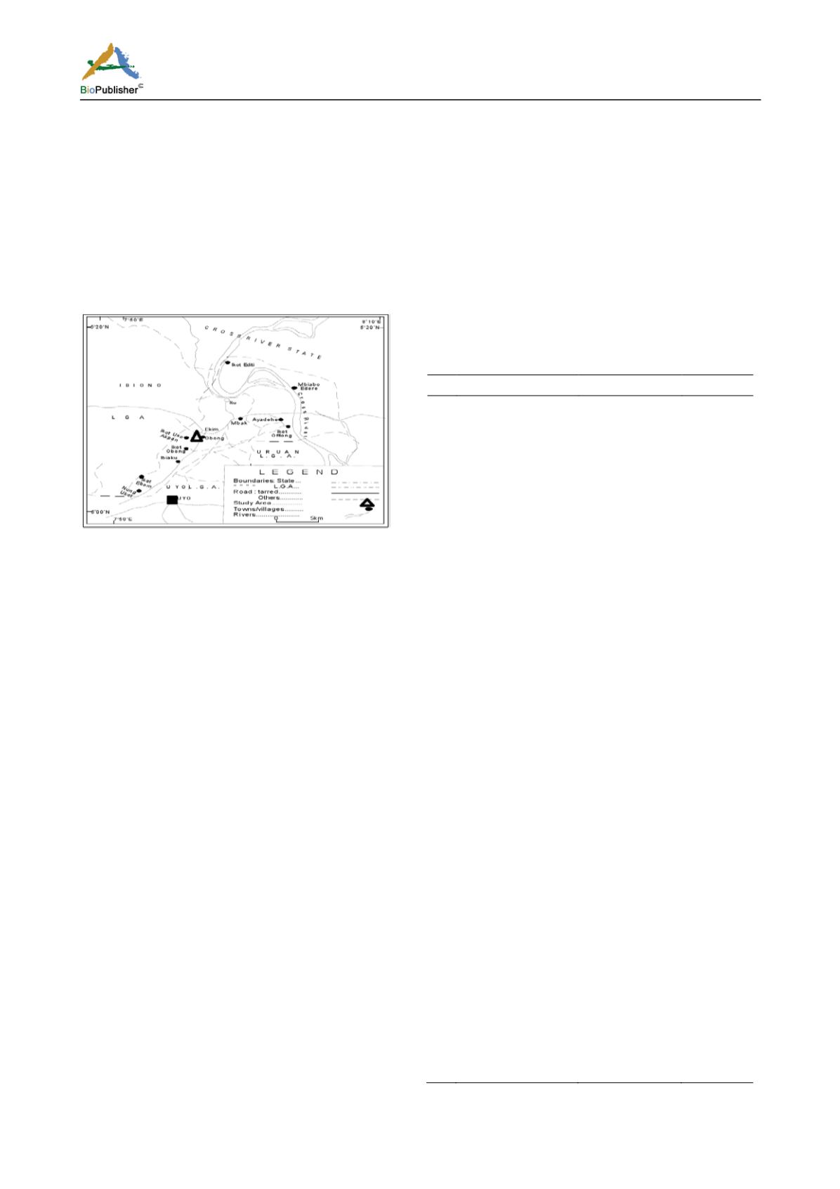
The vegetation of the area along the West and
southern line is a swamp forest and moist lowland
forest in the interline (Figure 1). The topography of
the area is highly undulating. The area has eight to
nine months of raining season and a short period of
three to four months of dry season. The area has a
mean annual rainfall ranges of 2500 to 3000 mm with
a mean annual temperature of about 26.1 ºC and a
relative humidity of 85% (Metz, 1992; Fasona and
Omojola, 2005).
Figure 1: Map of Akwa Ibom State showing study area
Source: Egwali et al. (2005)
Data Collection
To enable an overview of the forest profile, a
representative sample site within the forest fragments
in the study area was examined. A two inventory plots
of 50 × 50 m and 50 × 70 m within the community
forest were established and their boundary delineated
for data collection. Data collection was carried out
between February and June, 2012 and the following
parameter were collected for each tree with a diameter
at breast height (DBH) of 10 cm and above as
described by Quinten (2008); X/Y position within the
plot using a simple tape measurement; DBH,
circumference; Tree height; Bole height (height of
first branch); Crown dimension; and Identification of
the tree species.
Data Analysis
The enumerated plant species were classified
according to their families. The mean population
density per hectare of each species was determined
from its population in the 1.8 ha area assessed and the
total tree population per hectare was also computed
using SVS©. Also, the profile of the sample plots
were analyzed and displayed in a two dimensional
view using the program ‘TreeDraw©’ Version 3.0 and
Stand Visualization System (SVS).
Result
Vegetation Assessment
A total of 72 individual trees were recorded within the
two sample plots belonging to 25 species and 20
families. Anacardiaceae and Moraceae had the highest
number of trees present (10 trees) while Bignoniaceae,
Lauraceae, Palmae and Burseraceae had one (1) tree
species present respectively. The tree families and
species are listed in Table 1 and all data for the two
sample plots were subsequently processed to allow a
visualization of the forest stand in the form of a forest
profile (top view). The results of the exercise, based on
the program TreeDraw© is shown in Figures 1 and 2.
Table 1: Tree inventory of Okuku forest and Ikwat 1
ID
Tree Species
Family
Number
1
Musanga
cercopioides
R. Br.
Cecropiaceae
3
2
Xylopia aethiopica
(Dunn.) A. Rich
Malvaceae
2
3
Rothmannia
longiflora
Balisp.
Rubiaceae
3
4
Celosia argentea
Linn.
Amaranthaceae
5
5
Anillopsis soyauxii
(Peringuey)
Carabidae
4
6
Berlinia
grandiflora
(Vahl.)
Hutch
Leguminoceae
1
7
Autrenella
congolensis
(De
Wild) A. Chev.
Sapotaceae
1
9
Ballionoiia
toxisperma
Pierre
Sapotaceae
1
10
Spondias monbin
Linn.
Anacardiaceae
10
11
Coelocaryon
preusii
Warb.
Myristicaceae
5
12
Ficus
thoningii
Blume
Moraceae
10
13
Holarrhena
floribunda
(G.
Don) Dur and
Schinz
Apocynaceae
1
14
Homalium letestui
Pellegr.
Flacourtiaceae
5
15
Dacryodes edulis
(G. Don) H.J. Lam
Burseraceae
1
16
Macaranga barteri
Muell. Arg
Euphorbiaceae
2
17
Pentaclethra
macrophylla
Benth.
Fabaceae
4
18
Ceiba pentandra
(L.) Gaerth
Malvaceae
2
19
Dracaena
manii
(Bak.)
Dracaenaceae
1
20
Cinnamomum
zeylanicum
Verum
Lauraceae
1
21
Erythrina
senegalensis
DC
Leguminoceae
2
22
Newbouldia laevis
(P. Beauv.) Seeman
Bignoniaceae
1
23
Raphia
hookeri
(Mann and Wendl.)
Palmae
1
24
Rauvolfia
vomitoria
Afzelius
Apocynaceae
1
25
Tetrapleura
tetraptera
(Schum.
and Thom.)
Fabaceae
1


