International Journal of Marine Science, 2016, Vol.6, No.24, 1-8
2
equilibrium in the ecosystem. Condition factor compares the wellbeing of a fish and based on the hypothesis that
heavier fish of a given length are in better condition.
Some reports on other fish species include; Alfred-Ockiya, (2000),
Chana chana
in fresh water swamps of Niger
Delta and Hart, (1997),
Mugil cephalus
in Bonny estuary, Hart and Abowei, (2007), ten fish species from the lower
Nun River, and Abowei and Davies, (2009),
Clarotes lateceps
from the fresh water reaches of the lower Nun river.
They reported that, as a fish's condition increases, body water is replaced mainly by lipid and, to a lesser extent,
protein while ash content remains relatively constant.
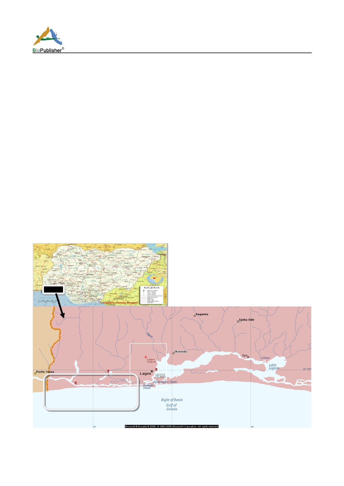
Study Area
The Badagry creek (Figure 1) is approximately 60 km long and 3 km wide, lies between longitudes 3°0′ and 3°45′
E and between latitudes 6°25′ and 6°30′ N. It is part of a continuous system of lagoons and creeks along the coast
of Nigeria from the border with the Republic of Benin to the Niger delta. Most of the year it is characterized by
fresh and slightly brackish water. The lagoon is approximately equidistant from the entrances of Lagos and
Cotonou harbors. As a result, it is influenced by tides and floods from the Lagos Lagoon and Cotonou harbour
through Lake Nokue and Lake Porto-Novo (Anyanwu and Ezenwa, 1988). The Yewa River with its tributaries,
Isalu and Ijomo is the major river emptying into the lagoon. Creeks connected to the lagoon include Bawa and
Doforo. Badagry creek is foumd in Lagos state in the southwestern part of Nigeria. The creek impacts
significantly on the lives of Lagosians. It is used for fishing, aquaculture, sand mining and as a means of
transportation. The creek is also important in conservation terms because of the great diversity of endemic species.
The Badagry creek is a long stretch of water body that runs parallel to the Atlantic Ocean in the south; it extends
from Lake Nokue near Port-novo, Benin republic to Apapa area of Lagos before opening up into the Atlantic
Ocean via Lagos harbour. Along the creeks the major occupation of the inhabitants is fishing, crop farming, and
mat weaving. There is diversity of fin and shell fishes in the creek.
Figure 1: Administrative map of Nigeria (above) showing the Hydrological map of the Lagos lagoon complex. The sample stations A
& B are indicated on the Badagry axis of the lagoon.
A
B


