International Journal of Molecular Evolution and Biodiversity 2016, Vol. 6, No. 2, 1-6
2
be taken to maintain ecological integrity of the park.
2 Materials and Methods
2.1 Study area description
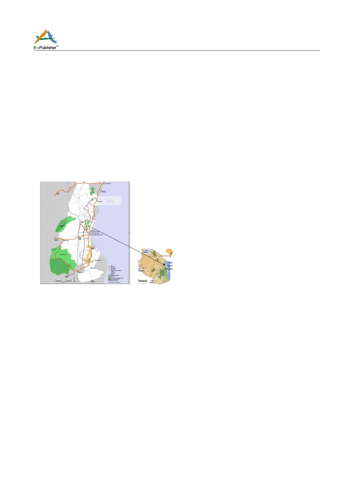
The study site is found on the South Eastern part of Saadani National Park in Bagamoyo District, Coast Region.
The park is located at 6
0
00'S 38
0
45'E (Figure 1). The park covers a total area of 1100 km
2
and was officially gazetted
in 2005 from a game reserve which had existed from 1969. The climate is coastal, hot and humid which offers a
unique combination of both marine and mainland flora and fauna. About 30 species of larger mammals are present
as well as numerous reptiles and birds. Some species of mammals include; Elephant (
Loxodonta africana
),
Hartebeest (
Alcelaphus buselaphus
), African Buffalo (
Syncerus caffer
). Waterbuck (
Kobus ellipsiprymnus
), Bohor
Reedbuck (
Redunca redunca
), Giraffe (
Giraffa camelopardalis
), Warthogs (
Phacochoerus africanus)
, Yellow
baboon (
Papio cyanocephalus
), Red Duiker (
Cephalophus harveyi
), Grey Duiker (
Sylvicapra grimmia
), Bushbuck
(
Tragelaphus scriptus
), Wildebeest (
Connochaetes taurinus
), Common Zebra (
Equus quagga
) as well as predators
such as the Lion (
Panthera leo
) and Leopard (
Panthera pardus
).
Figure 1 Location of the study site between Sea salt village and Kinyonga campsite
Note: Source from Saadani park website (2015) and Zambezi website (2008)
Rainfall is bimodal and annual precipitation ranges from 500 to 1 700 mm, with a mean of around 900 mm (Cochard
and Edwards, 2011). Short rains usually fall from October to December whereas long rains fall from March to early
June (Cochard and Edwards, 2011).
2.2 Data collection
This study was conducted in November 2014, in which a total of 100 plot-less points were established and 800
hundred trees having height of more than 2 m were sampled. The study was designed in such a way that we had ten
transect replicates each spaced at 700 m apart. Each transect had a length of 1km from the baseline (Wami River -
Chumvini village road) and we employed systematic sampling design to position ten points on each transect. After
establishing the first plot less point randomly from the baseline, we established nine replicates on each transect after
every 100m running from east to west. From each plot-less point we sampled 8 trees, two from each of the four
quarters/quadrants of a PCQ cross bar. In each of the quarters of a PCQ bar the circumference of two trees were
measured at a breast height (i.e. 130 cm from the ground) using a standard tape measure and recorded. Trees with
circumference at breast height (CBH) lower than 20cms represented "regenerating tree" and greater or equal to 20
cm represented "old trees". We also measured and recorded a point to the nearest tree distance in meters. In order
to estimate the amount of vegetation change we determined relative density as it is robust to seasonal changes and
species diversity which is sensitive to alteration.
2.3 Data analysis


